At 1,748 m above Queenstown, the Ben Lomond Track is a popular hike that dishes up a full day of adventure amongst rugged terrain and some of the most unforgettable scenery in the South Island. While easy to access—the route starts just a 10-minute walk from the town centre—it’s a demanding climb that crosses alpine tussock and rocky footing, rewarding you with 360° views of the region at the summit.
The Summit and Saddle Ben Lomond Tracks are accessible via trails from Queenstown central, or you can save an hour’s walk by riding the Skyline Gondola up to Bob’s Peak, the starting point.
Read our guide on preparing for the trek, accessing Bob’s Peak, and hiking the Ben Lomond Saddle Track and Summit Track.
Ben Lomond Track details
- Distance (return): 11 km
- Elevation gain: 1,438 m
- Duration (return): 3–4 hrs to Ben Lomond Saddle, 6–8 hrs to Ben Lomond Summit
- Difficulty: Advanced
- Best time of year: October–April
These stats include the hike from Queenstown Central via the Tiki Trail, but taking the Skyline Gondola up to Bob’s Peak will save you 1 hour (2.1 km) of walking.
Accessing Bob’s Peak
The Saddle and Summit Tracks start at Bob’s Peak, 480 m above central Queenstown. You can reach Bob’s Peak by riding the Skyline Gondola, or by hiking the Tiki Trail, Skyline Access Road, or One Mile Creek.
If you need to park your car, the Skyline Queenstown Carpark is right next to the Gondola and Tiki Trail entrance on Brecon Street. This car park is open 24/7 and features CCTV monitoring, so you can rest assured your belongings will stay safe while you climb up the mount.
1. Skyline Gondola

Image credit: Skyline Queenstown
From the bottom terminal of Skyline Queenstown, taking a scenic Gondola ride to the top of Bob’s Peak will save you (and your knees) up to one hour of hiking—that’s a 450 m ascent! Once you exit the Gondola, you’ll follow a well-signalled track through the woods, emerging into an opening that gives you the first views of Ben Lomond towering above.
The Gondola is also the best way to get back down to town after a long day of walking!
Skyline Gondola details
- Monday – Sunday: Check Gondola opening hours
- Price: Check Gondola pricing
2. Tiki Trail
The most common start to the Ben Lomond Hike is the Tiki Trail, which is located next to the Skyline Gondola Base Station. The track leads you through old Douglas firs and into some of Queenstown’s most beautiful native Beech forests. While a steep climb at first, it gets easier along the way.
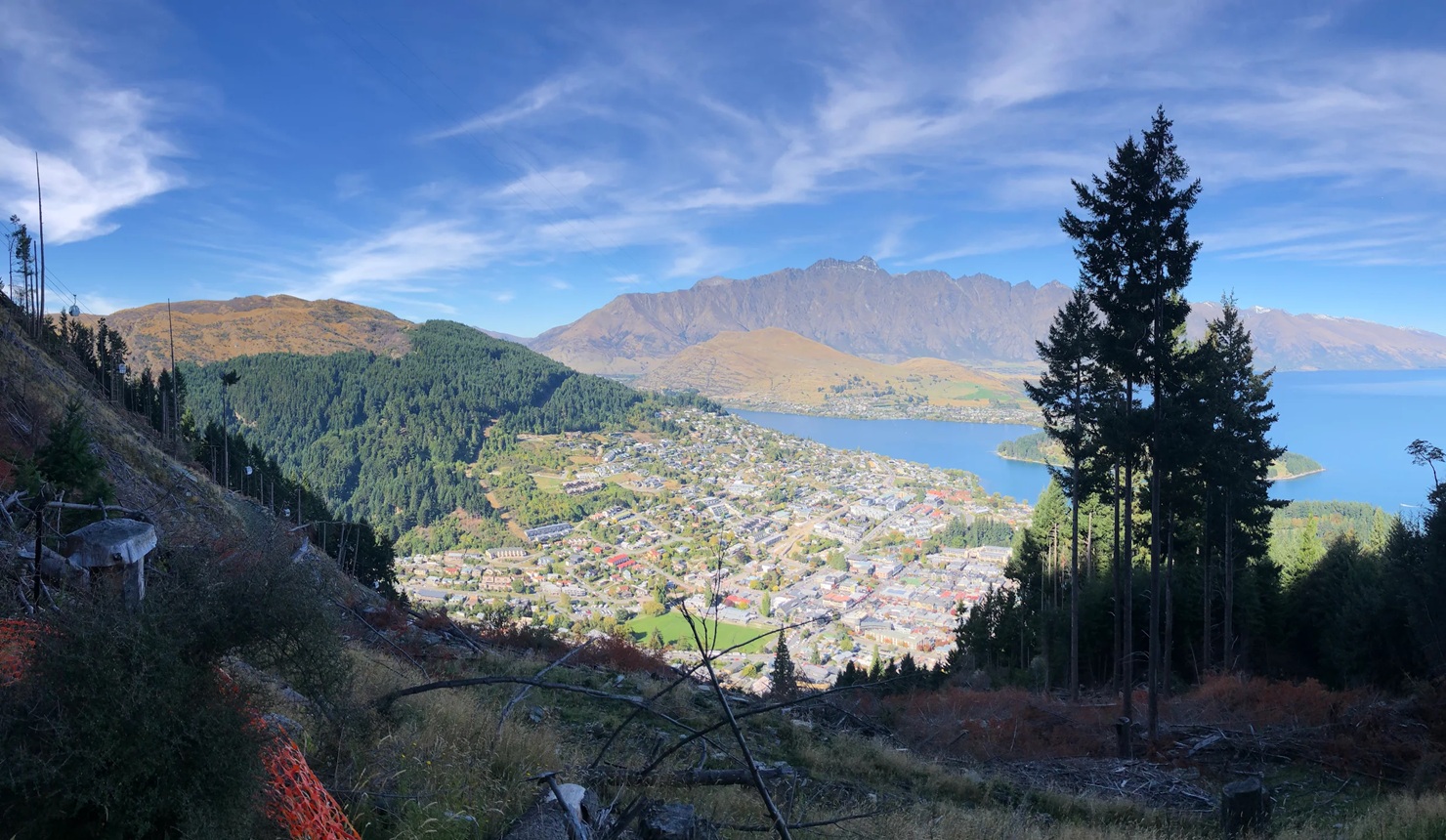
Image credit: Google Reviews
Throughout the Tiki Trail track, you’ll come across distinctive rest stops carved directly from pine trunks and hear zipliners zooming past overhead. Make sure to stay on the marked path, as there are several mountain bike tracks that weave through the hill.
Once you reach Bob’s Peak, you can take a break at the Skyline Café & Bar before continuing on to the rest of the Ben Lomond Hike.
Tiki Trail track details
- Distance: 2.1 km
- Elevation gain: 480 m
- Duration: 1 hr
- Difficulty: Moderate
3. Skyline Access Road
Skyline Access Road is a gravel path shared with bikers and supply vehicles. It’s the longest route up to the summit, so we recommend taking another path if possible.
If you do take this route, you’ll find the large, open Midway Clearing halfway to Bob’s Peak. Here, you can follow the signs to Ben Lomond Trail, which converges with another track coming from the Skyline complex.
Skyline Access Road track details
- Distance: 2.7 km
- Elevation gain: 387 m
- Duration: 1 hr
- Difficulty: Moderate
4. One Mile Creek
The final way to reach the Ben Lomond Track is the One Mile Creek Trail, which starts in Fernhill, near the Wynyard Jump Park. This track can be confusing and poorly signposted, so it isn’t the most popular hike.
One Mile Creek details
- Distance: 2.6 km
- Elevation gain: 216 m
- Duration: 1 hr
- Difficulty: Moderate
Hiking to Ben Lomond Saddle
If you’ve taken the Gondola or hiked up the Tiki Trail to Bob’s Peak, you’ll need to follow the signposts from the Skyline Complex to the Ben Lomond Track. Head up the walkway towards the Skyline Top Station. Once you’ve passed by the trackside picnic area, turn left onto the walkway which crosses over one of the Luge tracks. Follow the path into the forest.
Once you’ve broken out of the trees, you’ll see the clearly marked walking track contouring along a ridgeline. Despite the long and steady work to hike uphill, the views of the Remarkables and Lake Wakatipu will give you the inspiration you need to keep climbing!
Be careful not to venture onto the Beached As mountain bike trail, which runs alongside this track. Beached As flows well for the avid mountain biker, but sticking to the Ben Lomond walking track is definitely a much nicer and safer experience for those on foot.
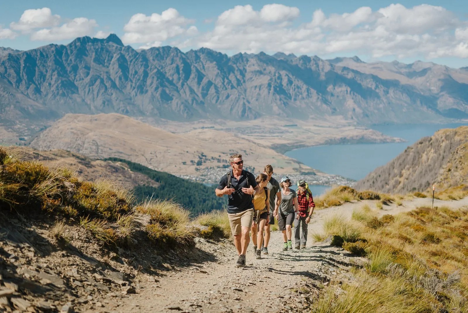
Image credit: Skyline Queenstown
After about an hour of hiking, you’ll reach the Ben Lomond Saddle—the route’s halfway point, where you can see the stunning peaks of Mt Aspiring National Park.
Here, you’ll find a bench seat at an intersection with the Moonlight Track. Take the opportunity to have a rest and fuel up with snacks. Make sure you pay attention to the time, assess the weather conditions, and gauge your confidence. Even in the height of summer, the elevation and wind exposure can cause cold temperatures, so be prepared to throw on a warm layer and a windproof jacket.
Ben Lomond Saddle track details (one way, from Bob’s Peak)
- Distance: 4 km
- Elevation gain: 536 m
- Duration: 2 hr
- Difficulty: Moderate
Hiking to Ben Lomond Summit
After the saddle, you’ll be in Ben Lomond Station, which is private land; keep to the formed track to avoid farm hazards! Again, you should assess your energy levels while you’re at the saddle. If you feel like you’ve already used up most of your energy, it might be better to head back and tackle the summit another day.

Image credit: Skyline Queenstown
The route from the saddle to the summit doesn’t require any specialised mountaineering equipment or experience in summer, but you’ll likely need to use your hands for balance. We recommend keeping your focus and body weight pointed towards the uphill side of the trail to avoid an uncomfortable fall.
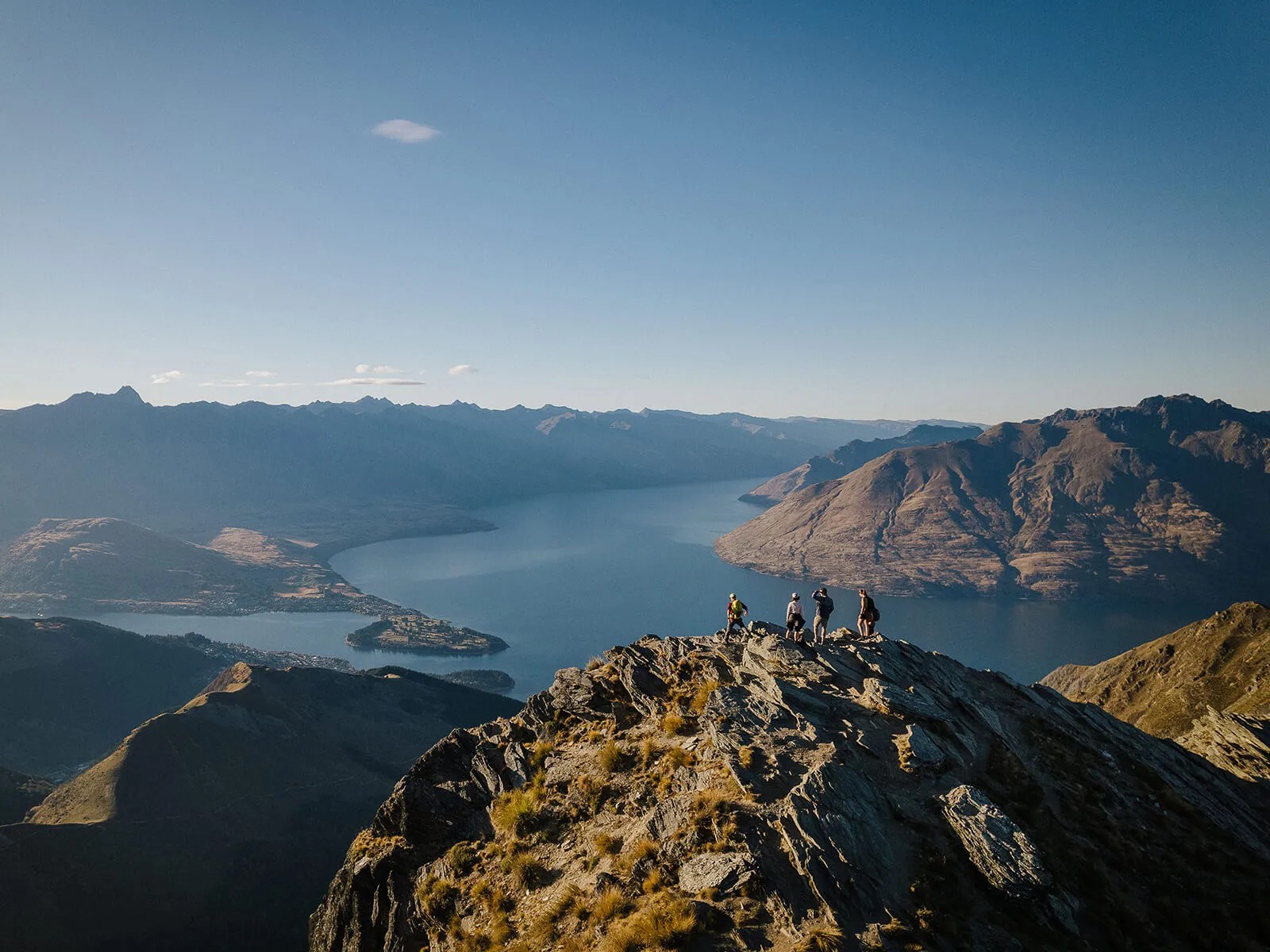
Upon reaching Ben Lomond’s peak, you’ll be treated to spectacular views of Queenstown, the Remarkables, and Mt Aspiring National Park. You may also find a Kea or two—a native New Zealand parrot that enjoys greeting hikers, sometimes by stealing their food!
Once you’ve soaked in the Ben Lomond summit view and snapped some pics, retrace your steps on the way back.
Ben Lomond Summit track details (one way, from Bob’s Peak)
- Distance: 5.5 km
- Elevation gain: 958 m
- Duration: 2.5–3.5 hr
- Difficulty: Moderate – difficult
Ben Lomond Tracks
| Walk | Ben Lomond Saddle Track | Ben Lomond Summit Track |
|---|---|---|
| Description | Half-day walk to the Ben Lomond saddle, offering beautiful views of the Mt Aspiring National Park. | Full-day hike to the peak of Ben Lomond, with views as far as Fiordland on clear days. |
| Elevation gain | 536 m (1,759 ft) | 958 m (3,143 ft) |
| Distance (return) | 8 km | 11 km |
| Duration (return) | 3–4 hrs | 5–7 hrs |
| Difficulty | Moderate | Difficult-moderate |
Ben Lomond Track FAQs

Image credit: Skyline Queenstown
When is the best time of year to hike the Ben Lomond track?
We recommend hiking the Ben Lomond Track during summer (October to May) as it offers the best chance of fine weather. During winter, the track is slippery and muddy from snow, so you must carry and know how to use alpine equipment, such as an ice axe and crampons.
For more information and up-to-date alerts about the Ben Lomond Track, visit the official Department of Conservation (DOC) website.
What should I pack for my hike up Ben Lomond?
The Ben Lomond Track is a full-day hike. As weather conditions can change rapidly, make sure you prepare:
- Food
- Plenty of water
- Extra warm layers
- Waterproof layers
- Sun protection (sunscreen and a hat)
- Sturdy footwear (we recommend high-top hiking boots)
- Communication device (in case you need assistance)
What time of day should I start hiking Ben Lomond?
Start early to ensure you have enough time to hike up and return while the sun is still out. If you’re beginning your walk to the summit from Bob’s Peak, start no later than 10:00 AM. If you’re beginning from Queenstown Central, taking the Tiki Trail, start no later than 9:00 AM.
How hard is the Ben Lomond Track?
The Ben Lomond Saddle hike is rated as a moderate hiking track, while the Summit Track is considered moderate–difficult. Including the Tiki Trail walking track, the full hike typically takes around 6–8 hours to complete, so you should be at a reasonable level of fitness.
Can a beginner do the Ben Lomond Track?
A beginner hiker who can walk for 2–3 hours should be able to complete the Saddle Track with no issues. The path to the summit of Ben Lomond is steeper, so it’s important to wear high-quality hiking boots. You might also have to use your hands at times!
Can kids climb the Ben Lomond Track?
Ben Lomond Track is suitable for both adults and children (6+ years) with a reasonable level of fitness. The main trails are clearly marked with orange poles, so it’s easy to stay on track!
Can you climb the Ben Lomond Tracks for free?
Yes, you can walk the Ben Lomond Tracks for free if you walk to Bob’s Peak via the Tiki Trail.
Are there toilets along the Ben Lomond Tracks?
There are toilets at the Skyline complex. DOC has also installed a drop toilet 100 m before the saddle. You’ll need to take your own supplies; you won’t find any water, hand sanitiser, or toilet paper there!
Plan your trip to Queenstown
If you’re looking for a beautiful day hikes in New Zealand, the Ben Lomond Track is well worth it for the spectacular panoramic views of Queenstown and the Wakatipu Basin. Don’t forget to stock up with snacks and drinks at the Skyline Café & Bar beforehand.
No visit to Skyline is complete without experiencing the Luge. Twilight sessions run from 7:00 pm during summer, and with a sunset that lasts ‘til 10:00 pm, you’ll have plenty of time to ride after completing the summit walk!
Explore more nature activities with our guide to the best walks in Queenstown.